By Craig Wheeler
Fri Jun 13 2025
Top 10 Scenic Places to Kayak Near Tampabay (Local Picks for 2025)
Looking to escape the hustle of everyday life and explore nature from the water? If you’ve ever searched “places to kayak near me”, you’re likely seeking peaceful, scenic, and accessible kayaking destinations — especially those with a public launch for easy entry.
Whether you’re a beginner paddler or a seasoned adventurer, Florida offers some of the most stunning waterways in the country. From crystal-clear springs to winding mangrove estuaries, each location below has been selected for its natural beauty, ease of access, and local charm.
Bookmark this guide for your next paddling trip in 2025. Each destination includes local launch details, Google Maps links, and insider tips to help you make the most of your kayak outing.
📍 1. Weeki Wachee River – Hernando County, FL
Why it’s one of the best places to kayak:
The Weeki Wachee River is a spring-fed waterway known for its vivid turquoise water, gentle flow, and frequent manatee sightings. It’s perfect for beginners or those seeking a relaxing paddle through a Florida paradise.
Launch Point: Weeki Wachee Springs State Park
Google Maps: Weeki Wachee Springs State Park
Insider Tip: Arrive early — the park limits the number of daily kayak launches. Morning paddles offer the clearest water and best chance to see wildlife.
Nearby Amenities: On-site kayak rentals, parking, restrooms, picnic tables, and a public boat ramp.
Local Wildlife: Expect to see manatees, turtles, otters, and a variety of birds including herons and egrets. The river is known for its underwater visibility, offering stunning views of aquatic plants and fish.
Route Details: The most popular stretch runs about 5.5 miles from the head spring to Rogers Park. It’s an easy, downstream paddle with shuttle services available.
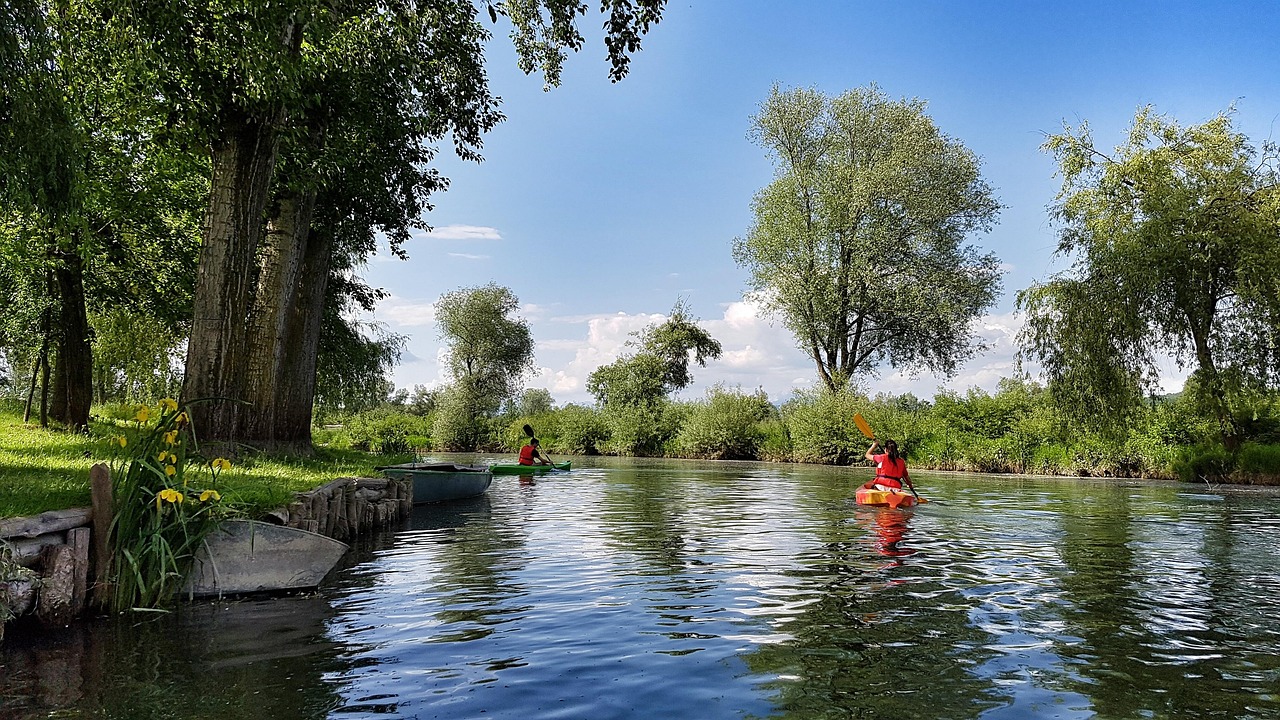
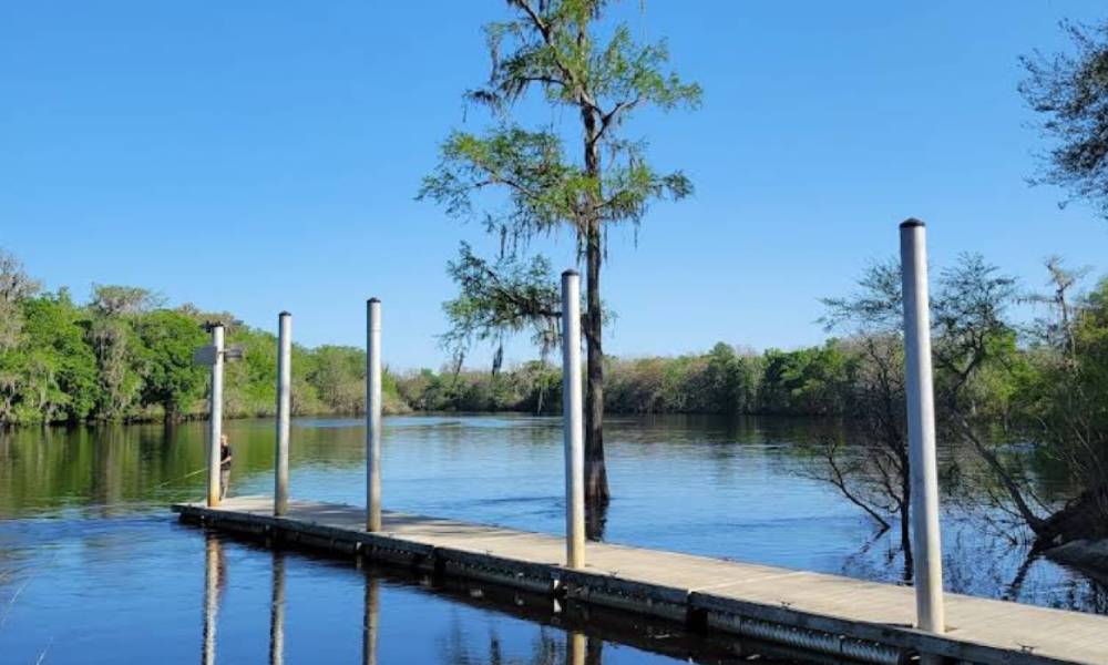
📍 2. Hillsborough River – Tampa, FL
Why it’s great:
Just outside the urban core of Tampa, this river immerses paddlers in a wild Florida landscape filled with cypress trees, birds, and the occasional alligator. It’s a peaceful reprieve for city dwellers and a true hidden gem.
Launch Point: John B. Sargeant Park
Google Maps: Hillsborough River Launch
Local Tip: Paddle downstream toward Morris Bridge Park for a serene 5.5-mile journey. There’s a public boat ramp at both ends for easy logistics.
Features: The river flows through a heavily forested corridor, providing ample shade and opportunities to observe turtles, ibis, limpkins, and even barred owls. The current is gentle, making it suitable for all skill levels.
Nearby Perks: Rest areas, bathrooms, nature trails, and plenty of parking at the launch. John B. Sargeant Park also has canoe and kayak rentals for those without gear.
Pro Tip: Bring binoculars if you’re a birdwatcher — this stretch of river is part of the Great Florida Birding Trail.
📍 3. Caladesi Island State Park – Dunedin, FL
Why it’s great:
This is one of the few undeveloped barrier islands left in Florida. Accessible only by kayak or boat, it offers secluded beaches, mangrove tunnels, and rich wildlife.
Launch Point: Causeway Community Park
Google Maps: Caladesi Kayak Launch
Pro Tip: Plan your paddle around high tide to make navigating the mangroves easier. Look out for dolphins, rays, and osprey on your way across the Intracoastal Waterway.
Launch Access: Free public access with multiple entry points, parking, and kayak rental vendors nearby.
What to Expect: The paddle from Dunedin Causeway to Caladesi Island is about 3 miles round-trip. The island features a kayak trail through mangrove forests and access to a pristine, quiet Gulf beach.
Amenities: Once on the island, you’ll find restrooms, shaded picnic areas, and hiking trails.
Local History: Caladesi Island was separated from neighboring Honeymoon Island by a 1921 hurricane and remains one of the most untouched coastal environments in Florida.
📍 4. Crystal River – Citrus County, FL
Why it’s great:
Crystal River is world-renowned for its crystal-clear freshwater springs and as a sanctuary for the Florida manatee, especially during winter months. The spring-fed waters stay a consistent 72°F, making it perfect for year-round kayaking.
Launch Point: Hunter Springs Park
Google Maps: Crystal River Launch
Seasonal Tip: Between November and March, manatees migrate to the warm spring waters. This is the best time to paddle alongside them, but be sure to follow all wildlife protection rules and keep a respectful distance.
Facilities: Hunter Springs Park offers a public boat ramp, dedicated kayak launch, paid parking, restrooms, and a small beach. Kayak rentals and guided tours are available nearby.
Wildlife Highlights: In addition to manatees, expect to see pelicans, cormorants, mullet, and perhaps even playful dolphins near the bay.
Scenic Route: Paddle out from Hunter Springs to Three Sisters Springs, one of the clearest and most photogenic spring areas in the state. The lush backdrop and glowing blue water make it a photographer’s dream.
E-E-A-T Note: Crystal River is monitored by the U.S. Fish and Wildlife Service to preserve its status as a manatee sanctuary. Kayakers are advised to review seasonal closures and paddle within the designated zones.
📍 5. Little Manatee River – Wimauma, FL
Why it’s great:
Tucked away in rural Hillsborough County, the Little Manatee River offers one of the most peaceful kayaking experiences in Central Florida. The shaded river winds through oak hammocks, pine flatwoods, and palmetto groves, creating a tranquil paddle that feels untouched by time.
Launch Point: Little Manatee River State Park
Google Maps: Little Manatee Launch
Best Route: Launch at the state park and paddle a downstream route toward the CR-579 bridge — a 4.5-mile stretch often considered the most scenic part of the river.
Wildlife Encounters: The river supports a wide range of species including deer, turtles, river otters, hawks, and gators. The dense canopy keeps the water shaded and cool, even on hot summer days.
Access Info: The park has a well-maintained public boat ramp, kayak rental services, and campgrounds for overnight stays.
Unique Feature: A portion of the river is designated as an Outstanding Florida Waterway, which means it’s specially protected for its natural and recreational value.
Extra Tip: Consider staying at one of the primitive campsites located along the river trail if you want a deeper wilderness escape.
📍 6. Shell Key Preserve – Tierra Verde, FL
Why it’s great:
Shell Key Preserve is a barrier island and protected marine reserve located between the Gulf of Mexico and Boca Ciega Bay. It’s a kayaker’s paradise with crystal-clear shallows, mangrove-lined creeks, and a soft white sand beach only accessible by watercraft.
Launch Point: Fort De Soto
Google Maps: Shell Key Launch
📍 7. Silver Springs – Ocala, FL
Why it’s great:
Silver Springs is one of Florida’s oldest tourist attractions, originally made famous by its glass-bottom boat tours. Today, kayakers can experience its crystal-clear spring waters, lush subtropical surroundings, and abundant wildlife up close and personal.
Launch Point: Silver Springs State Park
Google Maps: Silver Springs Launch
Water Clarity: With visibility up to 100 feet, this paddle feels like floating over an aquarium. Kayakers can easily spot fish, turtles, and aquatic plants below the surface.
Wildlife Encounters: It’s one of the few places in the U.S. where you might encounter wild rhesus macaque monkeys, which were introduced in the 1930s. Also expect to see otters, anhingas, gar, and even manatees in cooler months.
Paddling Routes: The Fort King Paddling Trail is a great 1.1-mile loop for beginners. For a longer journey, paddle downriver to Ray Wayside Park (about 5 miles), which offers shuttle services and a public boat ramp for pickup.
Amenities: Full visitor center, rentals, restrooms, picnic areas, and campgrounds make this a great weekend paddling destination.
Insider Tip: Avoid weekends if possible — Silver Springs is popular. Mid-week mornings offer the most tranquil experience.
📍 8. Myakka River – Sarasota, FL
Why it’s great:
As one of Florida’s official Wild and Scenic Rivers, the Myakka River offers a remote, untamed paddling experience through floodplains, prairie wetlands, and hardwood forests.
Launch Point: Myakka River State Park
Google Maps: Myakka Launch
Unique Terrain: This river has both slow, meandering sections and wider open water areas (called Upper and Lower Myakka Lakes), offering a variety of experiences in a single trip.
Wildlife Watch: Alligators are common here — in fact, this is one of the best spots in the state for seeing large congregations of gators. You’ll also see sandhill cranes, bald eagles, roseate spoonbills, and more.
Public Access: Myakka River State Park has a well-maintained public boat ramp, parking, rentals, and a nature center. The park also offers interpretive paddling tours for visitors who want to learn more about the ecosystem.
Pro Tip: Stick to the upper river in the dry season (winter–spring) for easier navigation and fewer bugs. In the summer months, the water level can fluctuate significantly.
Adventure Bonus: For those looking to extend the trip, primitive paddle-in campsites are available with a reservation.
📍 9. Rainbow River – Dunnellon, FL
Why it’s great:
Fed by Rainbow Springs, this river maintains a consistent temperature year-round and offers exceptionally clear water, perfect for floating, paddling, and snorkeling.
Launch Point: KP Hole Park
Google Maps: Rainbow River Launch
Ideal Conditions: The 5.7-mile stretch from KP Hole to Blue Run of Dunnellon Park is calm and easy to navigate, making it great for families and casual paddlers.
Aquatic Life: The clarity of the water makes this a top pick for seeing fish, turtles, and underwater vegetation. Bring a mask and snorkel to enjoy both above and below the surface.
Facilities: KP Hole features a public boat ramp, picnic areas, clean restrooms, and plenty of parking. Kayak rentals and shuttles are also available.
Rules to Know: Only non-motorized vessels are allowed upstream past the head spring area. This helps preserve the river’s pristine conditions.
Extra Advice: Arrive early on weekends and holidays — parking fills up quickly, and there are daily limits on river use to protect the environment.
📍 10. Chassahowitzka River – Homosassa, FL
Why it’s great:
Affectionately known as “The Chaz,” the Chassahowitzka River is a true hidden treasure of Florida’s Nature Coast. It’s fed by a network of freshwater springs and surrounded by dense forest and salt marshes, offering one of the most diverse and untouched kayaking experiences in the state.
Launch Point: Chassahowitzka River Campground
Google Maps: Chassahowitzka Launch
Notable Features: Paddle upstream to discover the Seven Sisters Spring, a series of interconnected underwater caves popular among snorkelers and adventurous kayakers. Downstream, the river opens into brackish estuaries teeming with marine life.
Wildlife to Spot: Expect to see manatees, otters, dolphins, mullet, and a variety of wading birds. The river’s remote nature means fewer crowds and more opportunities for peaceful exploration.
Launch Facilities: The campground has a public boat ramp, kayak rental shack, and ample parking. Lodging and RV camping are available if you want to extend your stay.
Paddling Experience: Chassahowitzka is perfect for kayakers who enjoy exploring side creeks and discovering hidden springs. It’s best navigated during high tide to reach some of the shallower spots.
Tip: Bring a waterproof GPS or download offline maps — the side creeks are beautiful but easy to get lost in!
🗺️ Bonus: How to Find a Public Boat Ramp (Anywhere in the U.S.)
Whether you’re at home or traveling, knowing how to locate a public boat ramp can make or break your paddling plans. Here are a few expert-recommended tools to find reliable access points:
✅ Online Tools
- BoatRampLocator.com: Free directory of ramps sorted by zip code, waterway, or amenity type.
- Google Maps: Search “public boat ramp near me” and use reviews/photos to evaluate access quality.
- State/County Parks Websites: Often have downloadable maps and ramp conditions, especially helpful after storms or closures.
🧭 Local Knowledge
- Outdoor shops and outfitters: Staff usually know where to find both popular and hidden ramps.
- Paddling forums and Facebook groups: Ask locals about current water levels and crowd status.
🧰 Checklist Before You Go
- Confirm tide and weather conditions
- Check for permit requirements or entrance fees
- Pack your PFD (personal flotation device), dry bag, sun protection, and enough drinking water
Pro Tip: Look for ramps that offer dual access for kayaks and boats. These locations tend to have better parking, loading zones, and on-site amenities.
🛶 Final Thoughts: Discover the Best Places to Kayak Near You in 2025
Florida is a paddler’s dream — from gentle spring runs to wild estuary adventures, there’s a kayak destination for everyone. Whether you’re launching from a public boat ramp or planning a cross-state trip, this list of top 10 scenic places to kayak helps you experience nature at its best.
In 2025, prioritize places that offer a blend of beauty, accessibility, and conservation. By doing so, you’ll not only enjoy incredible memories but help protect Florida’s unique waterways for generations to come.
🔍 Frequently Asked Questions (FAQs)
1. What’s the best time of year to kayak in Florida?
Winter through spring (November to April) is ideal for weather and wildlife sightings — especially manatees.
2. Do I need a permit to kayak at these locations?
Most state parks charge entry or launch fees but don’t require a boating permit. Always check park websites before visiting.
3. Can I bring my own kayak to these locations?
Yes! All locations allow personal kayak launches, and many also offer rentals.
4. What kind of kayak is best for Florida rivers and springs?
Sit-on-top kayaks are versatile for warm water paddling. Touring kayaks work well for longer distances and spring runs.
5. How can I find a public boat ramp while traveling?
Use BoatRampLocator.com or Google Maps. Always check for ramp conditions, tide timing, and possible closures before launching.
Looking for boat ramps near you? Use our free app to find launch locations with facility info and directions. Save your favorite boat ramps for quick access anytime. Download Boat Ramp Locator on Google Play.
Join our newsletter!
Enter your email to receive our latest newsletter.
Don't worry, we don't spam

Related Articles
-
 Sat Jul 19 2025
Guide to Boat Ramps in Tampa Bay
Tampa Bay has no shortage of accessible boat ramps, and many of them are open around the clock.
-
 Sat Jul 12 2025
Top 10 Hotels With Boat Docks in the Florida Keys
Finding a hotel that also offers boat docking can turn a good trip into an unforgettable seafaring a
-
 Wed Jul 09 2025
How to choose the best boat ramp on the Suwannee River for your boat size.
The Suwannee River is a legendary waterway in North Florida, winding through cypress forests, limest